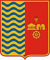
Balatonfüred
 |
The town has two marinas, a string of carbonated mineral water springs, listed buildings from the middle of the 18th and the 19th centuries and fine restaurants. It has modern hotels and guest-houses to accommodate about fifty thousand visitors in the summer. The nearest villages around Balatonfüred are Tihany, Aszófő, Balatonszőlős and Csopak, all renowned for their wine, land and beaches. Highway No 71 crosses the town as well as a single track railway line between Budapest and Tapolca. Although a shipyard was once the town's largest employer, now that place has been taken by the State Hospital for Cardiology. The largest industry is catering and providing boarding and other accommodations. The town has a pier, a harbour, a large camping site and several private marinas.
Visitors come for the mild micro-climate, scenery, the local wine, made of Olaszrizling grapes, and sailing and swimming facilities, as well as to revive the two-century-old tradition of socializing around spas, bathing and vacationing. The main events of the two-month-long summer holiday season include a ball for first-time visitors with a beauty contest and a wine-tasting festival, both in August.
Füred (short for Balatonfüred) has six comprehensive schools, three grammar schools, a secondary modern school for viniculture, the Lajos Loczy High School and Janos Ferencsik Music School (conservatory). A number of choirs, bands and sporting clubs are also present. The town has a local TV studio and a monthly newspaper. Füred has a newly built conference and sport centre as well.
There are three churches in the town: a typical red-sandstone Catholic church, a white Protestant church and a modern Evangelist church. A Pentecostal, American type of Christian denomination Faith Church is also active in the former Communist party headquarters.
Balatonfüred has a number of conference halls and a large clinic for heart patients. It also has a number of wine cellars that sell white house wine from the vineyards on the hillside overlooking the town and the lake.
In winter, the lake may freeze over for weeks so that skaters and ice boaters take over near the shore of the town.
Map - Balatonfüred
Map
Country - Hungary
 |
 |
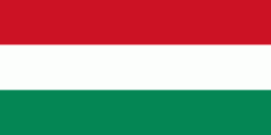
| Flag of Hungary | |
The territory of present-day Hungary has for centuries been a crossroads for various peoples, including Celts, Romans, Germanic tribes, Huns, West Slavs and the Avars. The foundation of the Hungarian state was established in the late 9th century AD with the conquest of the Carpathian Basin by Hungarian grand prince Árpád. His great-grandson Stephen I ascended the throne in 1000, converting his realm to a Christian kingdom. By the 12th century, Hungary became a regional power, reaching its cultural and political height in the 15th century. Following the Battle of Mohács in 1526, it was partially occupied by the Ottoman Empire (1541–1699). Hungary came under Habsburg rule at the turn of the 18th century, later joining with the Austrian Empire to form Austria-Hungary, a major power into the early 20th century.
Currency / Language
| ISO | Currency | Symbol | Significant figures |
|---|---|---|---|
| HUF | Hungarian forint | Ft | 2 |
| ISO | Language |
|---|---|
| HU | Hungarian language |


